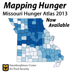
Missouri Hunger Atlas
New 2013 Edition Now Available
The Missouri Hunger Atlas – now in its 3rd edition – visually engages readers to better understand hunger in Missouri. Through a series of indicator maps and tables, the Atlas details the extent of food insecurity in all 114 Missouri counties and the city of St. Louis. The Atlas also assesses the performance of a host of public and private programs intended to help people struggling with hunger.
Key features of the Missouri Hunger Atlas
•County Tables for each county in Missouri (including the city of St. Louis) that measure rates of both food insecurity and program performance.
•State Maps that graphically illustrate patterns of food insecurity and program performance across the state.
•County Rankings, Comparisons, and Trends which rank counties based on need and performance measures, compare county measures with state averages, and indicate the trend for particular measures over time.
Download the Atlas
The Missouri Hunger Atlas 2013 may be downloaded in whole or part for free.
Full Report with County Profiles
Report without County Profiles – includes the background information, descriptions of indicators, state maps for many important indicators, county comparisons, and concluding remarks.

